![](/images/other/stat-length.png)
![Tour Wandern Le Diamant - La Cherry/Taupinière/La Cherry - Photo](https://media.geolcdn.com/t/1900/400/ext.pjpeg?maxdim=2&url=https%3A%2F%2Fmedia.geolcdn.com%2Ff%2F14edaf12-c346-4f56-9f09-e8deb58a7e6e.jpg)
La Cherry/Taupinière/La Cherry
Mabouya0462
Benutzer
![Länge](/images/other/stat-length.png)
Länge
12,5 km
![Maximale Höhe](https://static1.geolcdn.com/siteimages/upload/files/1508320355ic_sort_altitude_max_24dp.png)
Maximale Höhe
36 m
![Positive Höhendifferenz](https://static1.geolcdn.com/siteimages/upload/files/1508320355ic_sort_den_pos_24dp.png)
Positive Höhendifferenz
167 m
![Km-Effort](/images/other/stat-length.png)
Km-Effort
14,7 km
![Min. Höhe](https://static1.geolcdn.com/siteimages/upload/files/1508320355ic_sort_altitude_min_24dp.png)
Min. Höhe
0 m
![Negative Höhendifferenz](https://static1.geolcdn.com/siteimages/upload/files/1508320355ic_sort_den_neg_24dp.png)
Negative Höhendifferenz
167 m
![Boucle](https://static1.geolcdn.com/siteimages/upload/files/16400158638029165_repeat_loop_refresh_sync_direction_icon.png)
Boucle
Ja
Erstellungsdatum :
2024-03-24 11:19:55.663
Letzte Änderung :
2024-03-24 14:04:00.638
![Wandern](https://static1.geolcdn.com/sitytour/trail-icons/101.png)
2h43
Schwierigkeit : Medium
![Scannen Sie diesen QR-Code, um die Tour in der SityTrail-Anwendung zu öffnen](https://capi.geolives.com/qq0zvz2zws4bq2lad0pu/sitytour/trails/3992300/qr.png?size=200)
Kostenlosegpshiking-Anwendung
Über SityTrail
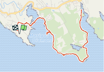
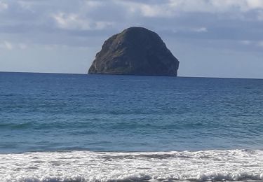
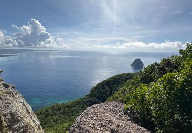
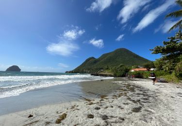
Tour Wandern von 12,5 km verfügbar auf Martinique, Unbekannt, Le Diamant. Diese Tour wird von Mabouya0462 vorgeschlagen.
Beschreibung
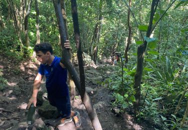
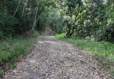
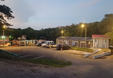
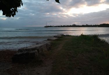
Marche, randonnée le long du littoral au Diamant
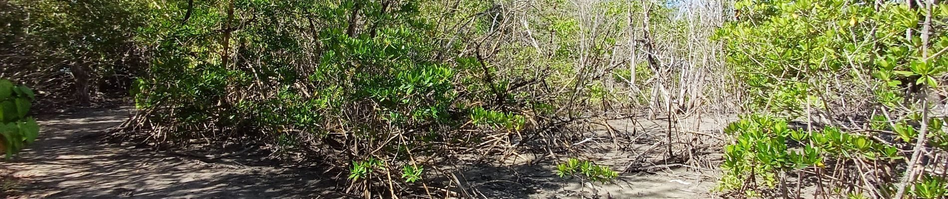
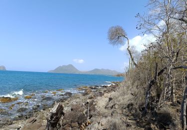
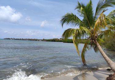
Ort
Land:
France
Region :
Martinique
Abteilung/Provinz :
Unbekannt
Kommune :
Le Diamant
Standort:
Unknown
Gehen Sie:(Dec)
Gehen Sie:(UTM)
714469 ; 1601153 (20P) N.
Kommentare
Touren in der Umgebung
![Tour Wandern Le Diamant - le Diamant de Taupinière vers O'mulane bas. - Photo](https://media.geolcdn.com/t/375/260/ext.jpg?maxdim=2&url=https%3A%2F%2Fmedia.geolcdn.com%2Ff%2F653f0fe3-b889-4758-982c-8d8f505a6e15.jpg)
![Wandern Wandern](https://static1.geolcdn.com/sitytour/trail-icons/101.png)
le Diamant de Taupinière vers O'mulane bas.
Wandern
Einfach
Le Diamant,
Martinique,
Unbekannt,
France
![](/images/other/stat-length.png)
5 km | 5,5 km-effort
2h 5min
![](https://static1.geolcdn.com/siteimages/upload/files/16400158638029165_repeat_loop_refresh_sync_direction_icon.png)
Ja
![Tour Wandern Le Diamant - Boucle Dizac, longuet, morne Larcher - Photo](https://media.geolcdn.com/t/375/260/ext.jpg?maxdim=2&url=https%3A%2F%2Fmedia.geolcdn.com%2Ff%2F7312d460-7ba1-4682-b0ba-c5cf683db0ef.jpg)
![Wandern Wandern](https://static1.geolcdn.com/sitytour/trail-icons/101.png)
Boucle Dizac, longuet, morne Larcher
Wandern
Le Diamant,
Martinique,
Unbekannt,
France
![](/images/other/stat-length.png)
11,2 km | 19,4 km-effort
4h 58min
![](https://static1.geolcdn.com/siteimages/upload/files/16400158638029165_repeat_loop_refresh_sync_direction_icon.png)
Ja
![Tour Wandern Le Diamant - O'Mullane bas vers la chérie en boucle. - Photo](https://media.geolcdn.com/t/375/260/ext.jpg?maxdim=2&url=https%3A%2F%2Fmedia.geolcdn.com%2Ff%2Fa195cd15-3add-4893-b6af-9a931553ed21.jpg)
![Wandern Wandern](https://static1.geolcdn.com/sitytour/trail-icons/101.png)
O'Mullane bas vers la chérie en boucle.
Wandern
Medium
Le Diamant,
Martinique,
Unbekannt,
France
![](/images/other/stat-length.png)
4,9 km | 5,8 km-effort
2h 0min
![](https://static1.geolcdn.com/siteimages/upload/files/16400158638029165_repeat_loop_refresh_sync_direction_icon.png)
Ja
![Tour Wandern Le Diamant - Morne Larcher - Photo](https://media.geolcdn.com/t/375/260/ext.jpg?maxdim=2&url=https%3A%2F%2Fmedia.geolcdn.com%2Ff%2Fe0e70ad0-2199-4b8a-a0ea-2efa1c5906b1.jpg)
![Wandern Wandern](https://static1.geolcdn.com/sitytour/trail-icons/101.png)
Morne Larcher
Wandern
Schwierig
(1)
Le Diamant,
Martinique,
Unbekannt,
France
![](/images/other/stat-length.png)
28 km | 43 km-effort
2h 36min
![](https://static1.geolcdn.com/siteimages/upload/files/16400158638029165_repeat_loop_refresh_sync_direction_icon.png)
Nein
![Tour Wandern Les Trois-Îlets - Haut de la pagerie vers Ancinel - Photo](https://media.geolcdn.com/t/375/260/ext.jpg?maxdim=2&url=https%3A%2F%2Fmedia.geolcdn.com%2Ff%2F257c83c8-1359-4a54-9463-9fed3453e8f1.jpg)
![Wandern Wandern](https://static1.geolcdn.com/sitytour/trail-icons/101.png)
Haut de la pagerie vers Ancinel
Wandern
Sehr leicht
(1)
Les Trois-Îlets,
Martinique,
Unbekannt,
France
![](/images/other/stat-length.png)
5,1 km | 7,7 km-effort
1h 40min
![](https://static1.geolcdn.com/siteimages/upload/files/16400158638029165_repeat_loop_refresh_sync_direction_icon.png)
Ja
![Tour Wandern Le Diamant - Dizac vers la maison du Bagnard - Photo](https://media.geolcdn.com/t/375/260/ext.jpg?maxdim=2&url=https%3A%2F%2Fmedia.geolcdn.com%2Ff%2F03163f2d-f1ea-4321-9fa3-308ef029cc2b.jpg)
![Wandern Wandern](https://static1.geolcdn.com/sitytour/trail-icons/101.png)
Dizac vers la maison du Bagnard
Wandern
Sehr leicht
Le Diamant,
Martinique,
Unbekannt,
France
![](/images/other/stat-length.png)
3,2 km | 3,8 km-effort
56min
![](https://static1.geolcdn.com/siteimages/upload/files/16400158638029165_repeat_loop_refresh_sync_direction_icon.png)
Nein
![Tour Wandern Le Diamant - taupinière dizac - Photo](https://media.geolcdn.com/t/375/260/ext.jpg?maxdim=2&url=https%3A%2F%2Fservices.sitytrail.com%2FGeolivesWS%2FDownloadMedia.ashx%3FTrailID%3D506238%26Media%3D20151226101643.jpg)
![Wandern Wandern](https://static1.geolcdn.com/sitytour/trail-icons/101.png)
taupinière dizac
Wandern
Sehr leicht
Le Diamant,
Martinique,
Unbekannt,
France
![](/images/other/stat-length.png)
8,9 km | 10,3 km-effort
2h 46min
![](https://static1.geolcdn.com/siteimages/upload/files/16400158638029165_repeat_loop_refresh_sync_direction_icon.png)
Nein
![Tour Wandern Le Diamant - Taupinière - Photo](https://media.geolcdn.com/t/375/260/ext.jpg?maxdim=2&url=https%3A%2F%2Fmedia.geolcdn.com%2Ff%2F06e6b9bd-5318-4c5f-964c-23c5f7329806.jpg)
![Wandern Wandern](https://static1.geolcdn.com/sitytour/trail-icons/101.png)
Taupinière
Wandern
Sehr leicht
Le Diamant,
Martinique,
Unbekannt,
France
![](/images/other/stat-length.png)
6,8 km | 8,1 km-effort
1h 48min
![](https://static1.geolcdn.com/siteimages/upload/files/16400158638029165_repeat_loop_refresh_sync_direction_icon.png)
Ja
![Tour Wandern Le Diamant - Taupinière - Mullane Bas - Photo](https://media.geolcdn.com/t/375/260/ext.jpg?maxdim=2&url=https%3A%2F%2Fmedia.geolcdn.com%2Ff%2F8cfab009-1357-419a-ac8c-bdc83f3122ae.jpg)
![Wandern Wandern](https://static1.geolcdn.com/sitytour/trail-icons/101.png)
Taupinière - Mullane Bas
Wandern
Sehr leicht
Le Diamant,
Martinique,
Unbekannt,
France
![](/images/other/stat-length.png)
5 km | 5,7 km-effort
2h 37min
![](https://static1.geolcdn.com/siteimages/upload/files/16400158638029165_repeat_loop_refresh_sync_direction_icon.png)
Nein